Skip to content
Home
About
Welcome
Who We Are
Governance
Staff
Apply
Directions
Accessibility
Communities
Barrington
Brookfield
Dover
Durham
Farmington
Lee
Madbury
Middleton
Milton
New Durham
Newmarket
Northwood
Nottingham
Rochester
Rollinsford
Somersworth
Strafford
Wakefield
Engage
Civil Rights
Committees
Notices and News
Blog
Social Media
Press Releases
Newsletter
Bits and Pieces
Calendar
Measure
Mapping and GIS
Data Collection
Performance Measures
Data Snapshot
Dashboards
Plan
Core Plans
Project Portal
COVID-19 Recovery
Municipal Assistance
Economic Development
Transportation
UPWP
Environment
Climate Adaptation and Resilience
Conservation and Natural Resources
Energy
Watershed Planning
Services
Reference
Acronyms
Document Library
Map Gallery
Meeting Material Archive
Resources
Economic Development Resources
Environment Resources
Age-Friendly Resource Guide
Land Use Resources
Mapping/GIS Resources
Transportation Resources
Search
Topic: Data Analysis
Regional COVID Data Snapshot – May 2021
July 16, 2021
Regional Data Snapshot 2021
July 16, 2021
Economic Benefit of Transit Storymap
June 30, 2021
Metro Plan 2021-2045
May 21, 2021
New Durham Road Surface Management System Report 2021 Update
March 1, 2021
SRPC Annual Building Permit Report 2019
February 24, 2021
Recycling Storymap
January 27, 2021
Bicycle LTS Map Viewer
January 21, 2021
Sea Level Rise Impacts Map Viewer
January 12, 2021
Dover Street Tree Inventory Dashboard
November 2, 2020
NH Geodata Portal
August 1, 2020
Bicycle LTS Maps
May 25, 2020
Performance Measures
May 15, 2020
Measure
May 15, 2020
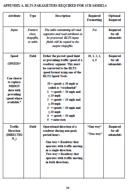
Bicycle Level of Traffic Stress Report Appendices
March 16, 2020
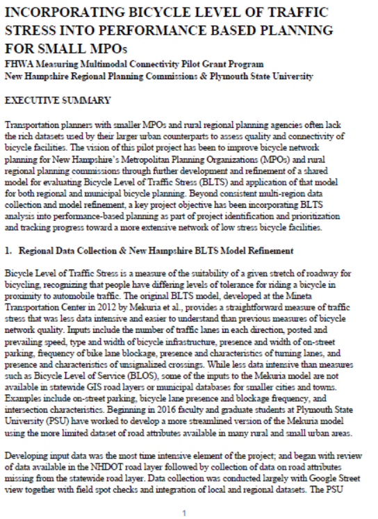
Bicycle Level of Traffic Stress Executive Summary
March 16, 2020
Bicycle Level of Traffic Stress Report
March 16, 2020
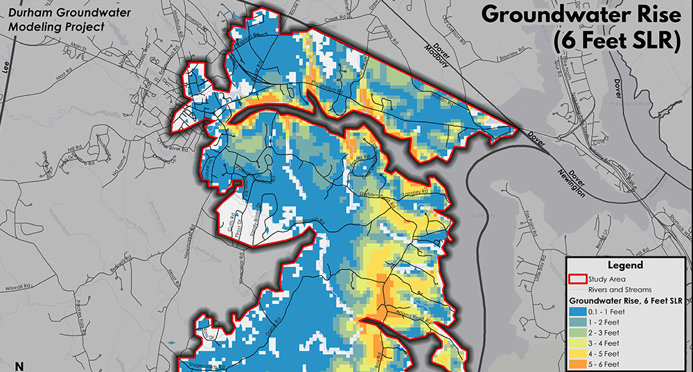
Durham Groundwater Rise Modeling
March 1, 2020
New Durham Build Out Analysis – Steep Slopes and Aquifers Map
January 21, 2020
New Durham Build Out Analysis – Water Resources Map
January 21, 2020
Page
1
Page
2
Page
3
Page
4
Page
5