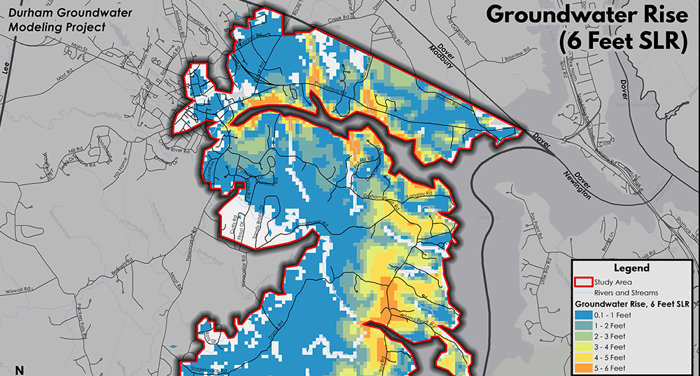
This project was funded through the Clean Water State Revolving Fund (CWSRF) Loan Program, which is administered by the State of New Hampshire Department of Environmental Services (NHDES). The Groundwater Rise Modeling project aimed to identify future vulnerabilities from impacts of sea level rise on rising groundwater and saltwater intrusion to Durham’s public and private drinking water, private septic systems, municipal critical facilities, stormwater infrastructure, roads, utilities, and contaminated sites.
The project team consisted of SRPC, JFK Environmental LLC, and the University of New Hampshire. The project was also informed by a technical advisory committee including Durham staff, members of the Coastal Adaptation Workgroup, and staff from the NHDES Watershed Assistance Section, Wastewater Engineering Bureau, and Coastal Program.
SRPC was charged with providing overall project administration, as well as assistance with the vulnerability assessment and development of strategies and planning recommendations within the project’s final report.
The final report is intended to communicate findings from the modeling results in a user-friendly way with clear steps outlined for the future.