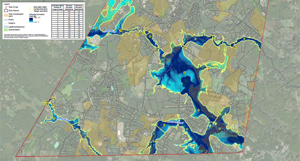
SRPC, in partnership with Geosyntec and the University of New Hampshire, used funding from the NHDES Coastal Program to prepare planning-level potential flood inundation maps using future projections for the mainstem of the Lamprey, North, Little, and Oyster Rivers within the Town of Lee. Projections included higher rainfall events and future land use changes. As part of this effort, planning commission staff also prepared draft revisions to the Town’s floodplain regulations that included a review of current design standards and inclusion of the potential inundation areas into the ordinance (as of August 2021, these revisions have not been incorporated).