Search
Close this search box.

Lee Floodplain Study – 2005 Estimated Floodplain

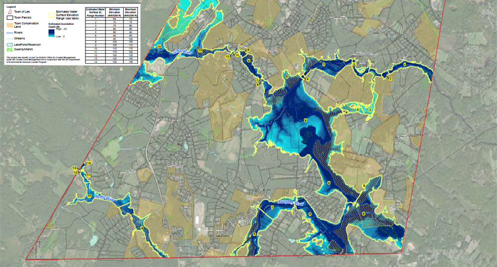
This is a planning level map that depicts potential flood inundation for the mainstem of the Lamprey, North, Little, and Oyster Rivers within the Town of Lee. Two versions of the maps were created. This map shows the current (2005) 100-year flood event.

Topics

Related Projects and Services

Map showing estimated surface elevation and inundation for the inundation mapping project in Lee
Click image to open the map
Thumbnail for the Lee Floodplain Study 2005 Estimated Floodplain map
Click to open the map

Staff