Durham Groundwater Modeling Maps
These maps were created for the Durham Groundwater Modeling project.
The Town of Durham, in partnership with the Strafford Regional Planning Commission (SRPC), the University of New Hampshire (UNH), and JFK Environmental Services LLC, applied for and received funding from the CWSRF Loan Program to conduct a study to determine the susceptibility of public and private drinking water supplies, private septic systems, contaminated sites, stormwater infrastructure, utilities, roads, and municipal critical facilities in low-lying areas to groundwater rise and saltwater intrusion.
The goal of the project was to improve Durham’s understanding of future groundwater rise vulnerabilities, build off and expand UNH’s ongoing research on the impacts of sea-level rise on groundwater, and ultimately enable Durham decision-makers to better plan for future conditions so that the Town can continue to improve water quality in the Great Bay Estuary.
Figure 5.1: Groundwater Rise (2 Feet SLR)
Figure 5.2: Groundwater Rise (4 Feet SLR)
Figure 5.3: Groundwater Rise (6 Feet SLR)
Figure 5.4: Groundwater Rise (8 Feet SLR)
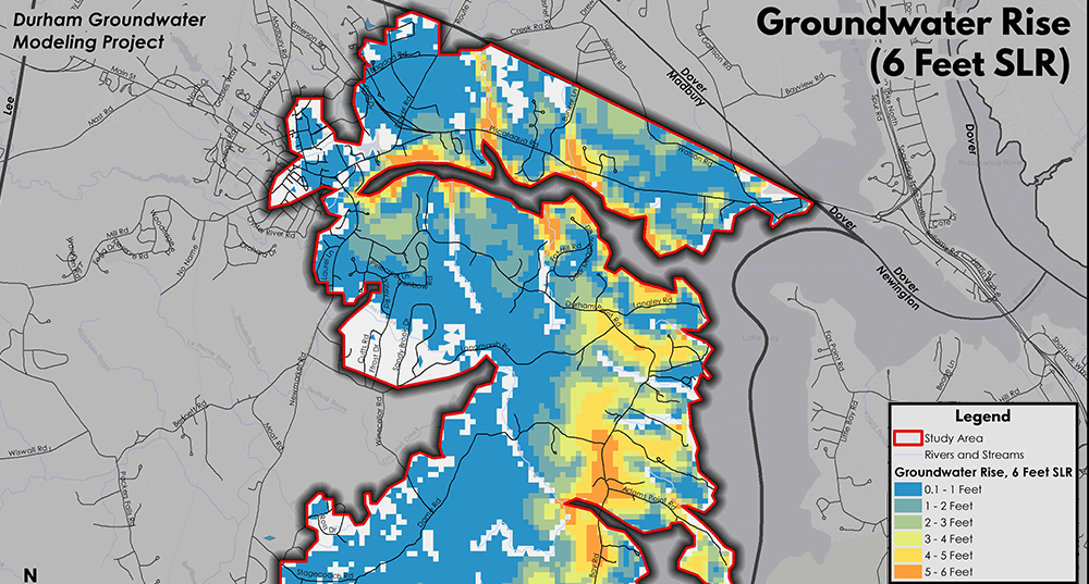
Figure 6: Groundwater Rise (6 Feet SLR)
Figure 7: Depth to Groundwater, Current Conditions
Figure 8: Intersect Analysis to Determine Most Vulnerable Areas
Figure 9: Most Vulnerable Areas
Figure 11: Saltwater Intrusion (8 Feet SLR)
Figure 12: Impacted Assets – Stormwater Infrastructure (Points)
Figure 13: Impacted Assets – Stormwater Infrastructure (Lines)
Figure 14: Impacted Assets – Municipal Critical Facilities (Points)
Figure 15: Impacted Assets – Municipal Critical Facilities (Lines)
Figure 16: Impacted Assets – Private Infrastructure
Figure 17: Impacted Assets – Private Infrastructure and Clusters
Figure 18: Impacted Assets – Contaminated Sites
Figure 19: Impacted Assets – Other Utility Infrastructure
Figure 20: Saltwater Intrusion (8 Feet SLR) and Public Water Supply Wells


