Tides, Camera, Action!

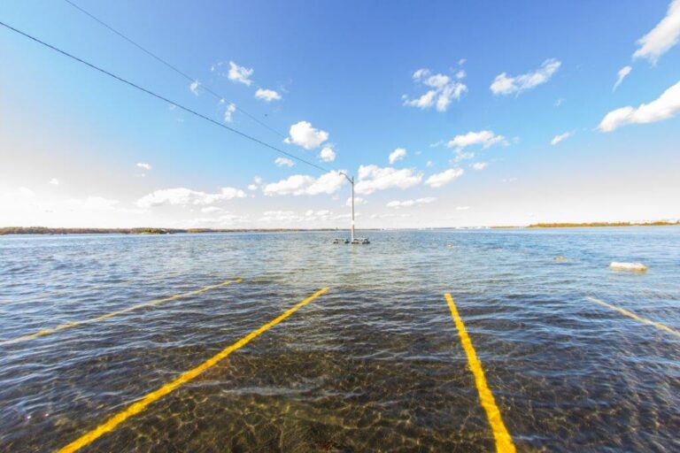
In Mid-October citizens from around the Seacoast took to the streets in an attempt to snap the perfect picture of this year’s king tide. Hoping for first place, participants submitted their photos of the abnormally high tide to NH Coastal Adaptation Workgroup’s (NHCAW) King Tide Contest. This yearly challenge, which is aimed at drawing attention to sea-level rise along the New Hampshire coast, saw over 130 submissions from 52 participants this year.
For those landlubbers who are not aware, a king tide, as defined by the Environmental Protection Agency (EPA), “is the highest predicted high tide of the year at a coastal location.[1]†These extreme tides are a result of the alignment of the Earth, Sun, and Moon and can be synonymous with local tidal flooding[2]. Over time the height and severity of these King Tides will worsen, due to projected sea-level rise worldwide. This fact, along with the implications, is what NHCAW hopes to convey through their yearly contest. As the EPA puts it, “Sea level rise will make today’s king tides become the future’s everyday tides.[3]â€
This is a concern to the State of New Hampshire as well. In 2013 Senator David Watters (Dover), along with Senator Nancy Stiles (Hampton) and Senator Martha Fuller (Portsmouth), submitted Senate Bill 163 to address this issue. Following the passing of this bill, the Coastal Risk and Hazards Commission (CRHC) was established through RSA 483-E in July 2013. The Commission was created to “recommend legislation, rules and other actions to prepare for projected sea-level rise and other coastal watershed hazards such as storms, increased river flooding and storm water runoff, and the risks such hazards pose to municipalities and state assets in New Hampshire.[4]â€
Throughout the past three years the Commission, which was made up of legislators, regional planners, NHDES staff, NH Fish and Game staff, municipal staff from NH’s coastal communities, and a variety of other stakeholders (for the complete list see RSA 483-E), worked to compile a listing of recommendations for taking a proactive approach to sea level rise. These recommendations, which was compiled in the form of a report, was released earlier this week on November 30, 2016.
More specifically, the Preparing New Hampshire for Projected Storm Surge, Sea-Level Rise, and Extreme Precipitation is a “set of recommendations for state legislators, state agencies, and coastal municipalities to help these audiences better prepare for and minimize coastal risks and hazards. The report presents a summary of the best available science and vulnerability information followed by recommendations for action.[5]â€
Next steps in the effort to address sea-level rise in New Hampshire include the use of the report’s recommendations within the report to guide the NH Setting SAIL project. This NOAA Project of Special Merit, administered through the NH Department of Environmental Services (NHDES), is a joint initiative on behalf of Strafford Regional Planning Commission, and numerous other entities such as Rockingham Planning Commission, UNH Cooperative Extension, & NH Fish and Game. The project will dovetail with the work that was done by the Coastal Risk and Hazards Commission through the implementation of recommendations presented in the report. The project began in October and will run through September 2017.
For more information, and to read a copy of the report, visit the NH Coastal Risk and Hazards Commission webpage at http://www.nhcrhc.org/.
[1] https://www.epa.gov/sites/production/files/2014-04/documents/king_tides_factsheet.pdf
[2] https://www.epa.gov/sites/production/files/2014-04/documents/king_tides_factsheet.pdf
[3] https://www.epa.gov/sites/production/files/2014-04/documents/king_tides_factsheet.pdf
[4] http://www.nhcrhc.org/wp-content/uploads/2016-CRHC-final-report-section-0.pdf
[5] http://www.nhcrhc.org/wp-content/uploads/2016-CRHC-final-report-section-0.pdf
